Open Daily 8a-6p | 530-582-0909 | [email protected]
Slideshow Items
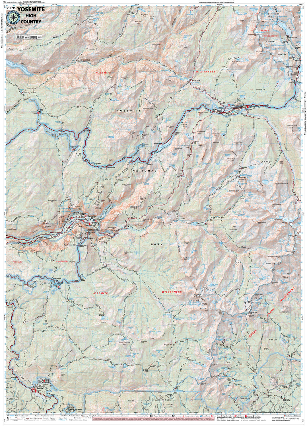
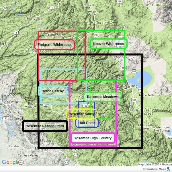
Detailed topographic map | Merced Lake, Wawona, Tuolumne, & More
Explore the Yosemite high country with this detailed topographic map, which gives contours, trails and other information for campers, hikers, and outdoor enthusiasts.Within this map is;Merced Lake * Wawona * Ten Lakes * Tuolumne Meadows * Tioga Pass * Vogolsang * Bridesveil Creek GPS compatible! Complete UTM Grid. Beautifully design over the USGS topographic quads, enhanced with shaded relief.
Carousel items
You cart is currently empty