Open Daily 8a-6p | 530-582-0909 | [email protected]
Slideshow Items

20 Different Zones off of HWY 550 | Wide Range of Terrain & Difficulty
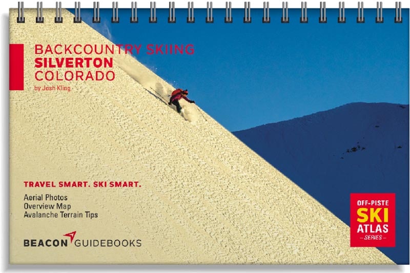
The San Juan Mountain Range speaks for itself when it comes to remote and rugged terrain in the west. Highway 550, passing over three passes (Red Mountain, Molas and Coal Bank) and through the heart of the town of Silverton, brings power-hounds to some of Colorado’s most coveted and diverse backcountry ski terrain. The locations showcased in this ski atlas offer the entire spectrum of terrain and difficulty. Provided you already have a small amount of experience as a backcountry skier and have some level of avalanche knowledge, there is something in this atlas for everyone.
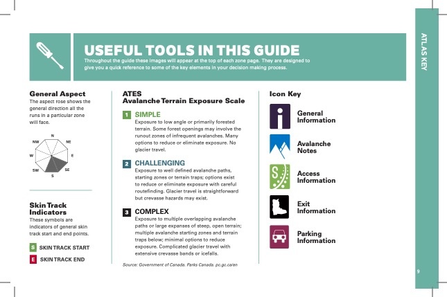
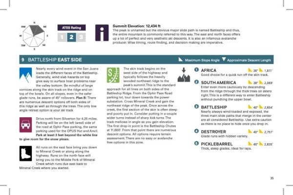
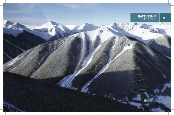
The completely updated 3rd edition offers new zones, new tour link-ups and traverses, a new map and more complete avalanche terrain information. You’ll find high-quality aerial photos marked with ascent and descent indicators, individual run descriptions, slope angles, aspect, Avalanche Terrain Exposure Scale ratings, parking and trailhead information and more in this lightweight and compact book that can fit in your pack. Designed to go along with you on your tours and accompany the Backcountry Skiing Silverton Ski Map and Ski App.
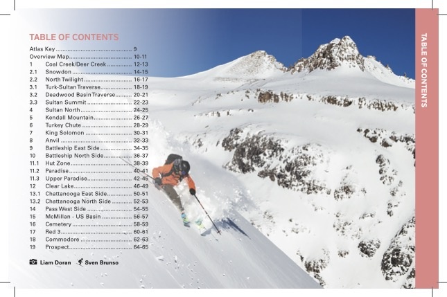
This 5.5” x 8.5” spiral-bound book covers the following zones: Coal Creek/Deer Creek, Snowdon, North Twilight, Turk-Sultan Traverse, Deadwood Basin Traverse, Sultan Summit, Sultan North, Kendall Mountain, Turkey Chute, King Solomon, Anvil, Battleship East & North Side, Pass West Side, McMillian/US Basin, Cemetery, Red 3, Commodore, and Prospect.
Carousel items
You cart is currently empty