Open Daily 8a-6p | 530-582-0909 | [email protected]
Slideshow Items
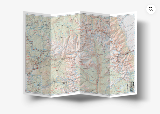
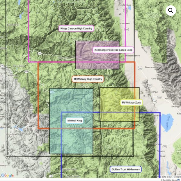
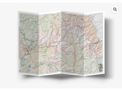
GPS Compatible, complete UTM grid | Waterproof and tear-resistant
GPS Compatible, complete UTM grid. Printed on waterproof and tear resistant material. Covers Pear Lake, Lodge Pole, Mineral King, Mt. Whitney, Kern Canyon, Ash Mountain, Whitney Portal, Little 5 Lakes, Bearpaw Meadow, Triple Divide Peak, with inserts for Cottonwood Lakes-Horseshoe Meadow Trailhead. Arguably the best map for the Whitney High Country
Carousel items
You cart is currently empty

![Wolverine Publishing Backcountry Skiing California's Eastern Sierra 3rd Edition [Greenberg & Mingori]](https://cdn.shoplightspeed.com/shops/619643/files/17097269/450x338x2/wolverine-publishing-backcountry-skiing-california.jpg)